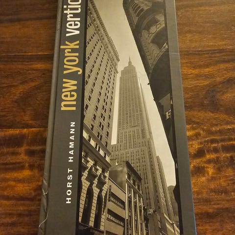

Bildegalleri
(1/8)
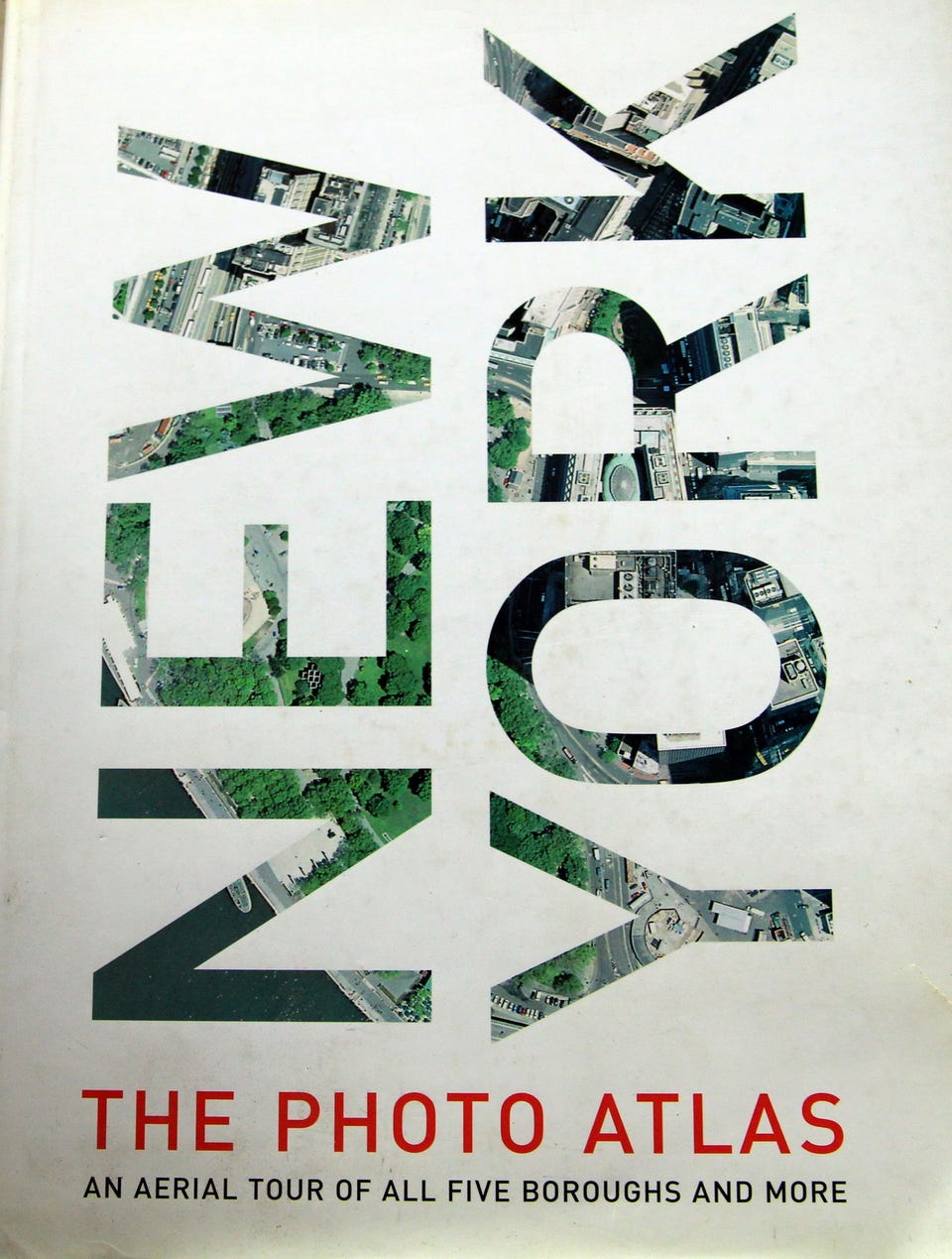
New York: The Photo Atlas .
Til salgs
575 kr
Frakt fra 119 kr + Trygg betaling 56 kr
Trygg handel med Fiks ferdig
Etter levering har du 24 timer til å se over varen. Hvis det er noe galt med varen, får du pengene dine tilbake.
Beskrivelse av varen
Tilstand: Som ny - Ikke synlig brukt
Product details
Publisher : Harper Collins
Publication date : September 21, 2004
Edition : First Edition
Language : English
Print length : 400 pages
ISBN-10 : 0060594993
ISBN-13 : 978-0060594992
Item Weight : 7.5 pounds
Dimensions : 10.75 x 1.25 x 14.25 inches
New York: The Photo Atlas An Aerial Tour of All Five Boroughs and More Hardcover – September 21, 2004.
Editorial Reviews
From Publishers Weekly
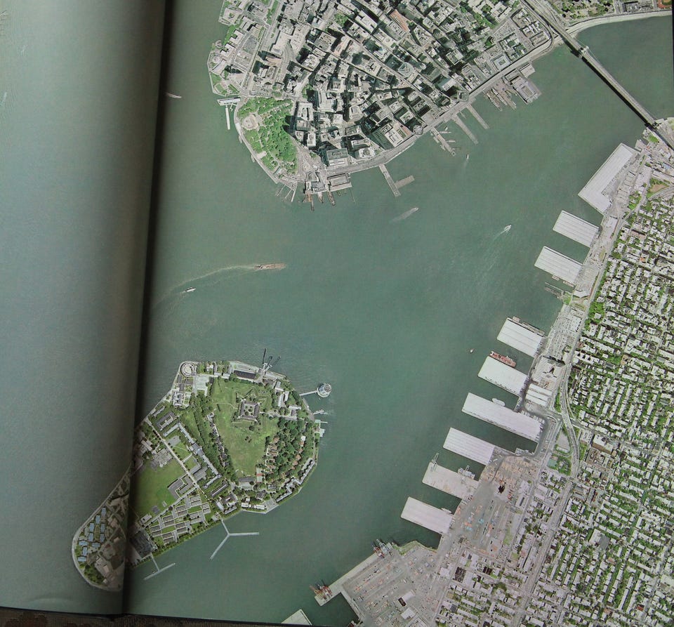
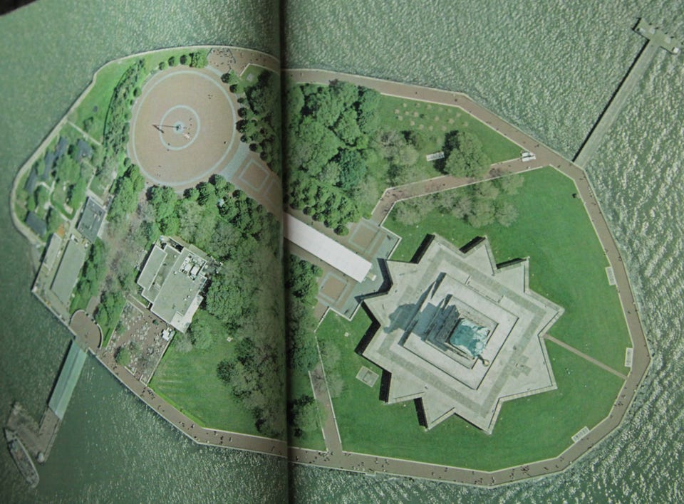
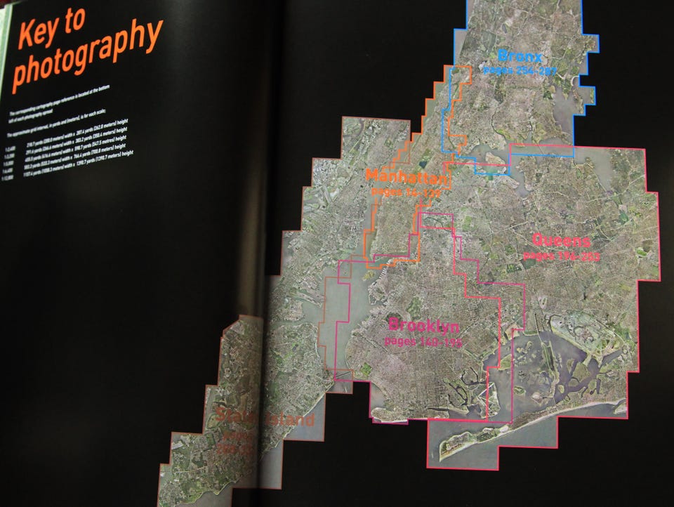
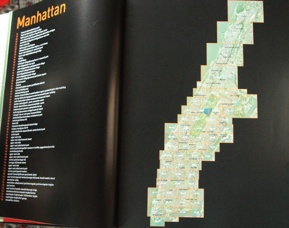
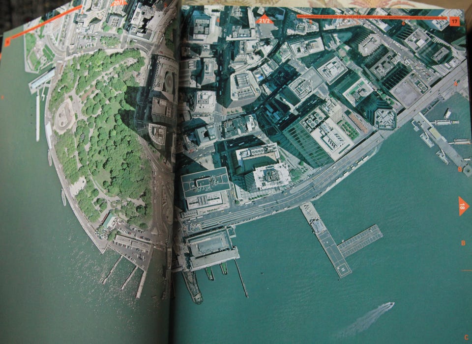
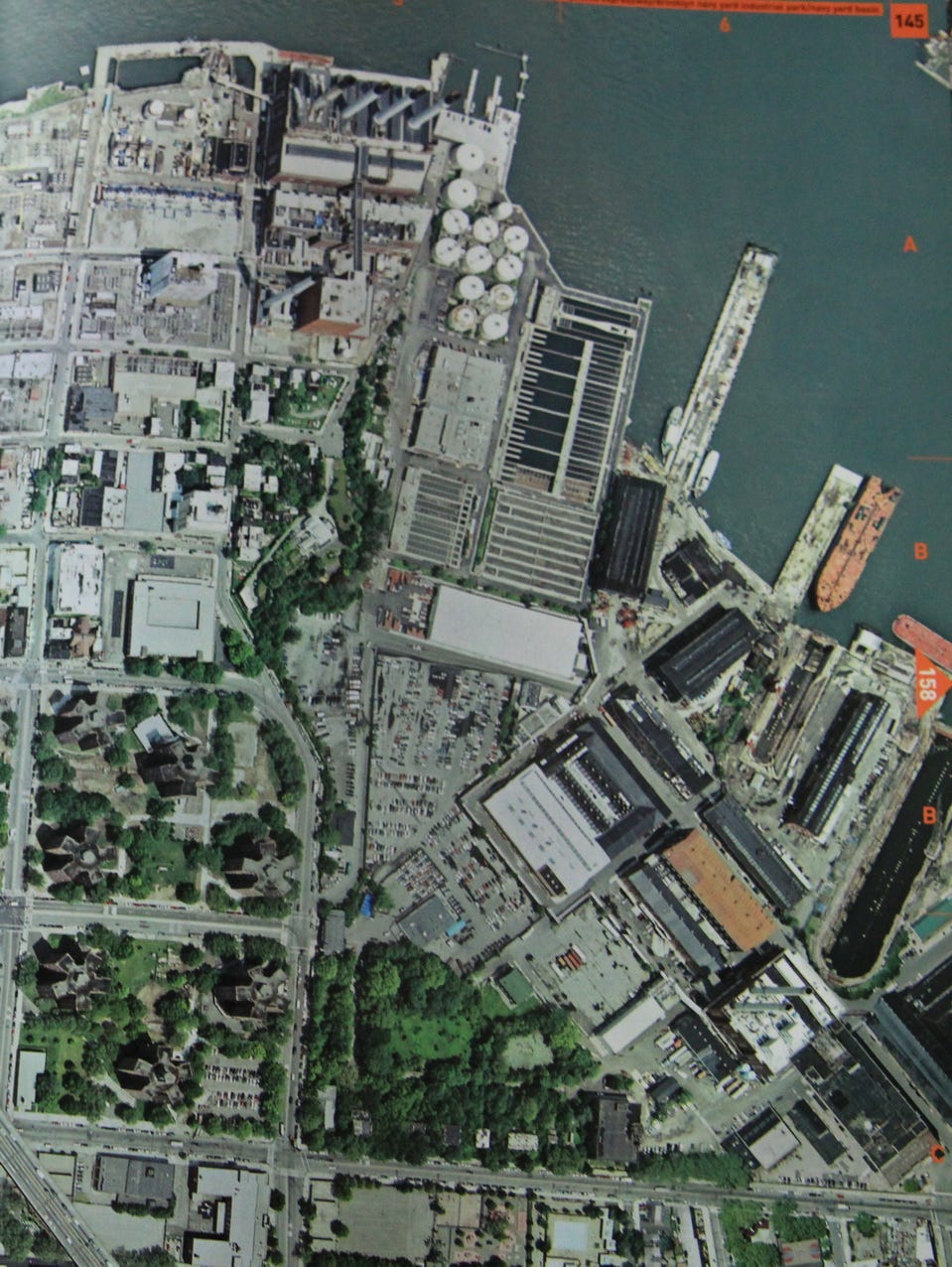
From thousands of feet up, New York, with its grid of blocks, looks more like a circuit board than a city; its bodies of water more like airbrushed spills than the gigantic moats they in fact are. This giant book is just what it says it is: New York City photographed from space, with accompanying maps that give names to the bleached out, anonymous-looking checkerboards that appear in the photos snaked through with light-looking lines of asphalt—more than 40,000 streets in all. The scale of this 10½" × 14½" book, and its weight, add to the sense of enormity; readers will soon zoom in, however, flipping back and forth between maps containing their favorite blocks or sites and pictures showing them with their surrounding environs. For anyone who has ever pored over an atlas and filled it in with their mind's eye, this city-between-covers will be a wish come true.
Copyright © Reed Business Information, a division of Reed Elsevier Inc. All rights reserved.
From the Back Cover
For those who think they know the streets of New York City like the back of their hand, think again. For those who don't know how to get around Gotham, here's a chance to get to know the city in all its glory. New York: The Photo Atlas combines exquisite aerial photography and de-tailed street atlas maps to provide a truly unique perspective of the city -- high above the concrete. The breadth of the area covered is stunning: All five boroughs are included, as well as several New York and New Jersey suburbs. Trace your bike route, find your apartment building, or take in the sights without leaving your living room. Even if you don't know New York well, you will find this book fascinating.
The atlas is a breeze to use. The photography and the cartography share the same standard grid system so you can cross-reference quickly between the two elements, and every street in the area shown is indexed for both types of maps. Both the photography and cartography are "map accurate": the photography has been geo-corrected, a process that removes the distortions in the original aerial photography. Every street in NYC -- more than 40,000 in total -- has been indexed with two page numbers, one relating to the photos and the other relating to the cartography.
Both native and honorary New Yorkers will be thrilled to own the groundbreaking New York: The Photo Atlas -- the most revealing New York atlas ever published.
NB: Knappen for å vise hele beskrivelsen har kun en visuell effekt.
Brukerprofil

Du må være logget inn for å se brukerprofiler og sende meldinger.
Logg innAnnonsens metadata
Sist endret: 4.8.2025 kl. 12:50 ・ FINN-kode: 419883897